2.4.1 Triangulation vs Trilateration
Trilateration Measures Distance, Not Angles
How does the GPS system pinpoint your location using trilateration?
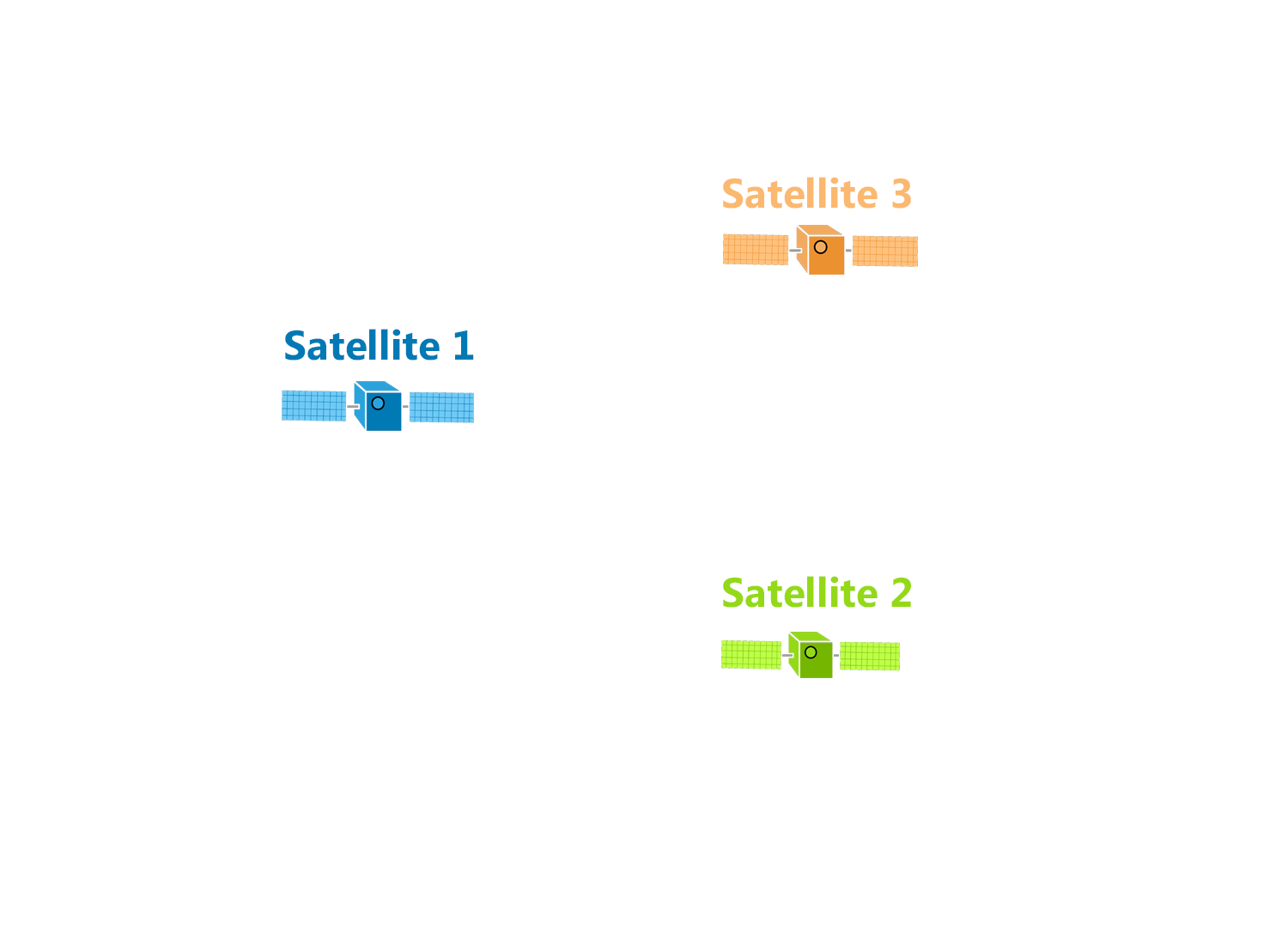
Using a simple two-dimensional example, let’s imagine we have three GPS satellites each with a known position in space.
Using a simple two-dimensional example, let’s imagine we have three GPS satellites each with a known position in space.
Really, all that satellites do is broadcast a signal for your GPS receiver to pick up with a specific time and distance.
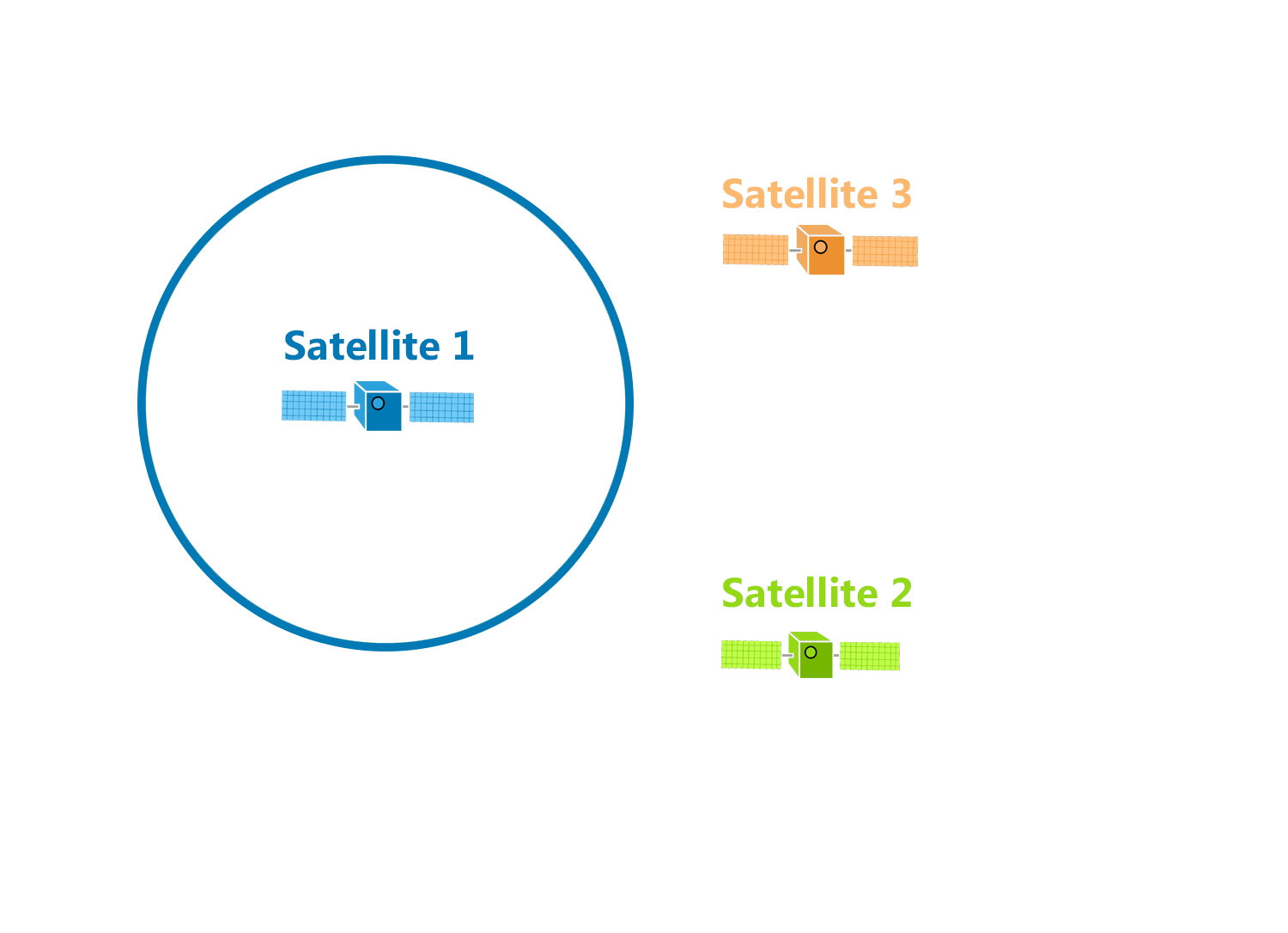
For example, the first satellite broadcasts a signal that eventually hits your GPS receiver. We don’t know the angle, but we do know the distance. That’s why this distance forms a circle equal in all directions.
This means that your GPS position could be anywhere on this circle at this specific radius.
What happens when your GPS receives a second signal?
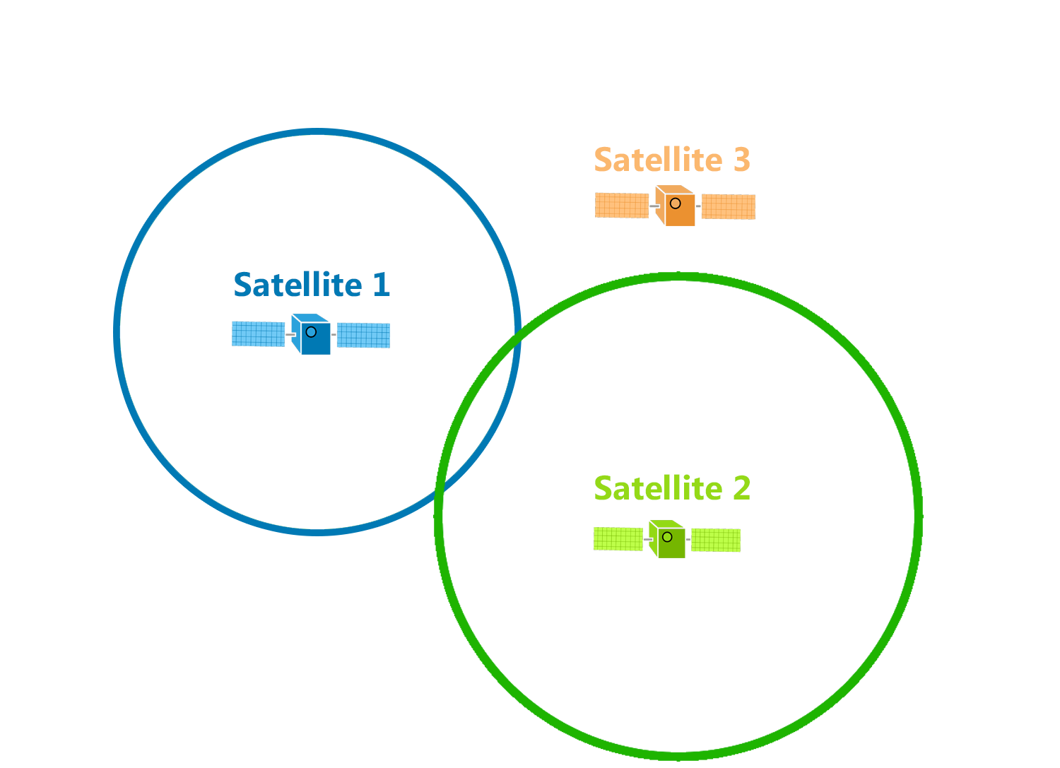
Again, this distance is equally broadcasted in all directions until it hits your GPS receiver. This means that the distance could be anywhere on that circle.
But this time, we have two known distances from two satellites. With two signals, the precise position could be any of the two points where the circles intersect.
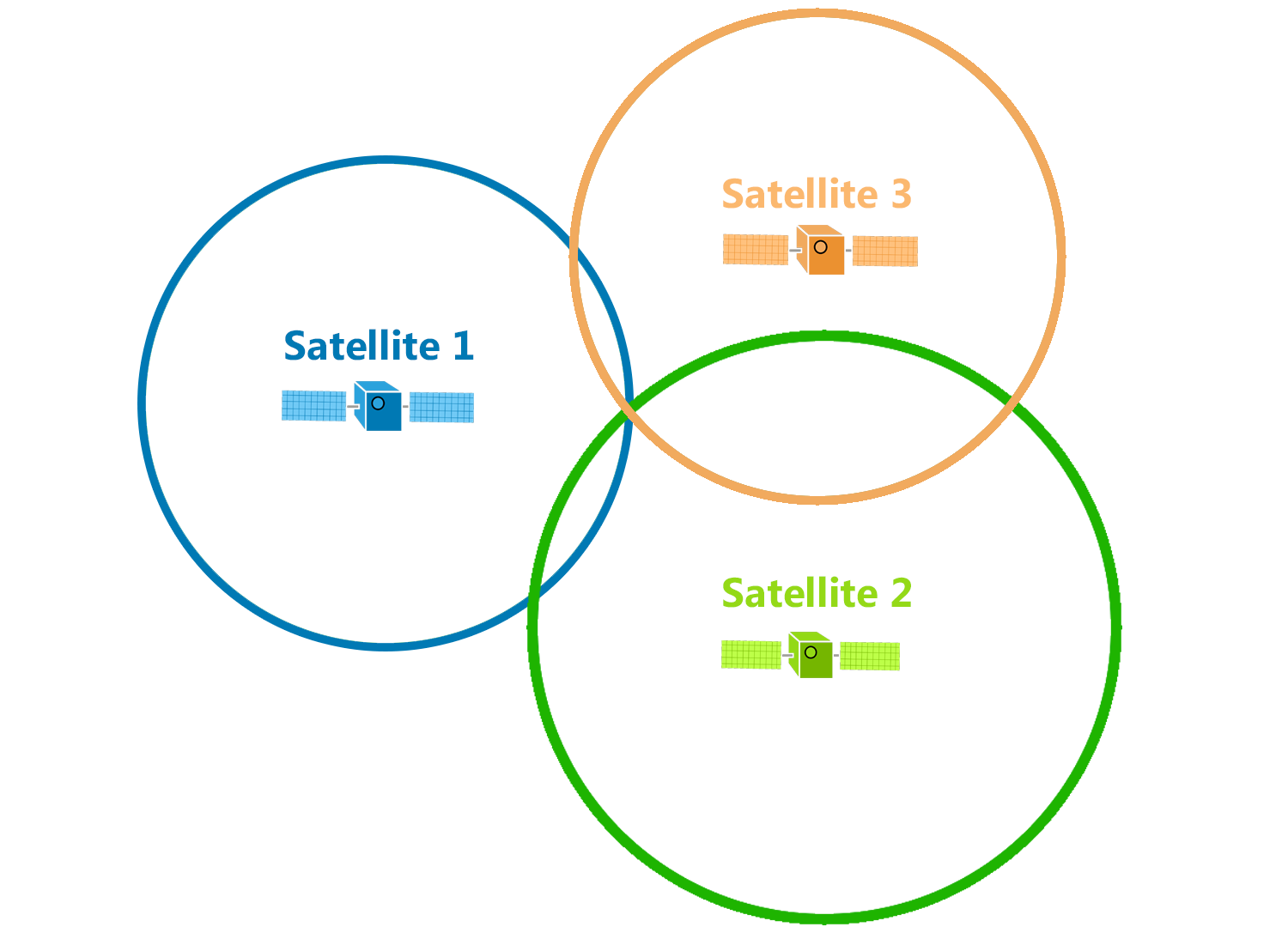
Because we have a third satellite, it reveals your true location where all three circles intersect.
Using three distances, trilateration can pinpoint a precise location. Each satellite is at the center of a sphere and where they all intersect is the position of the GPS receiver.
As the position of the GPS receiver moves, the radius of each circle (distance) will also change.
Using three distances, trilateration can pinpoint a precise location. Each satellite is at the center of a sphere and where they all intersect is the position of the GPS receiver.
As the position of the GPS receiver moves, the radius of each circle (distance) will also change.
But the reality is in our three-dimensional world that GPS satellites broadcast signals as a sphere.
Each satellite is at the center of a sphere.
Where all spheres intersect determines the position of the GPS receiver.
Triangulation Measures Angles, Not Distance
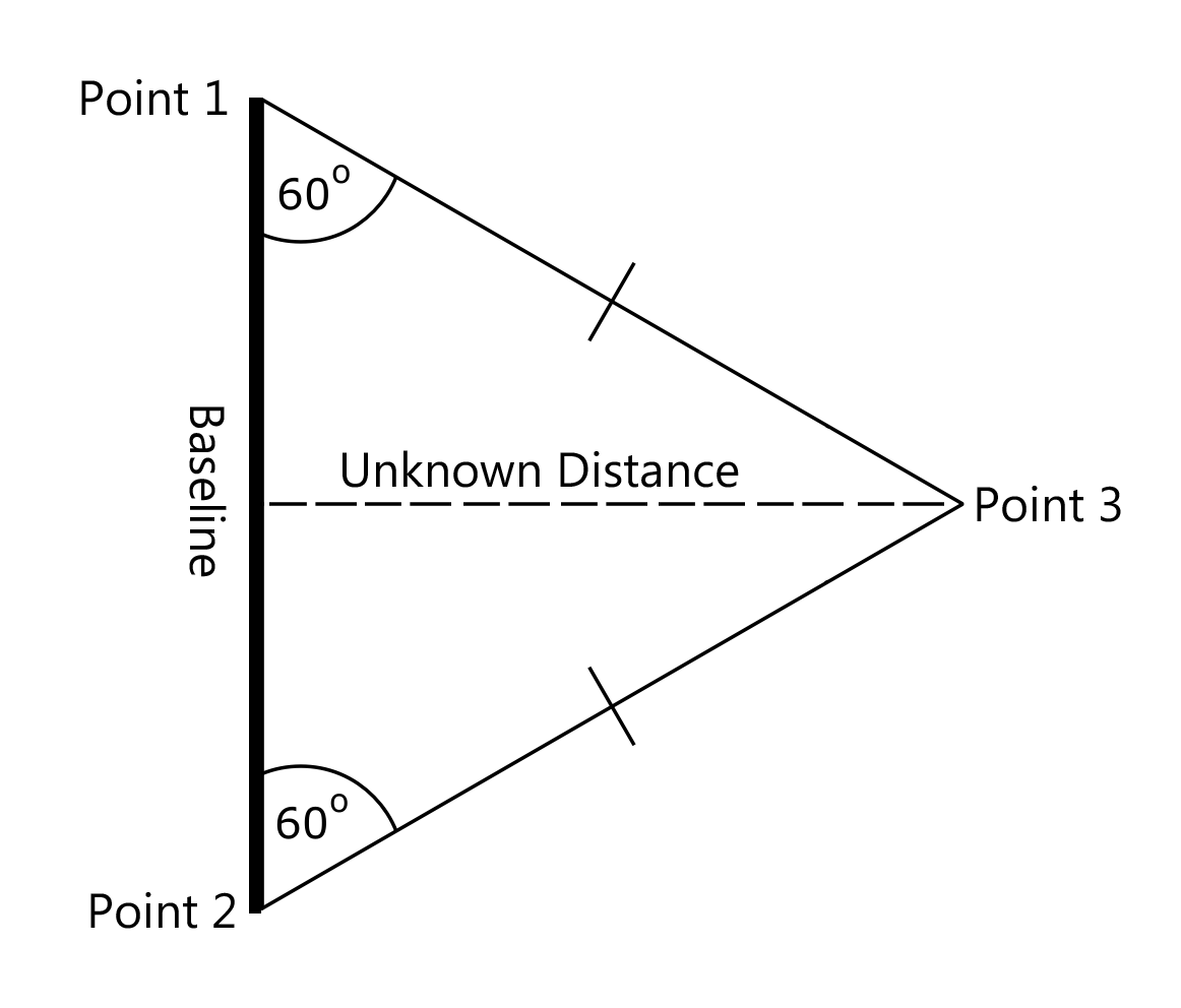
On the other hand, surveyors use triangulation to measure unknown distances. They do this by establishing a baseline length.
From each point, surveyors measure angles of distant points use instruments such as theodolites. When we know the lengths and angles, triangulation determines the distances by forming triangles, as shown in the diagram above.
For example, surveyors gathered approximately 26,000 stations from Maede’s Ranch in Kansas to create the North American Datum of 1927 (NAD27). But the Global Positioning System uses the World Geodetic Survey (WGS84) to reference positions.[1]
2.4.2 Satellite Navigation
- The position information can be established via GPS as long as good communication signals can be received from the satellites.
- If the connection between the GPS receiver and the satellites is compromised in any way, then real-time position information will be lost.
- The signals may be compromised due to:
- the surrounding landscape, valleys, hill etc.
- tunnels
- buildings.
- To counteract these problems, vehicle navigation systems use an additional method called composite navigation (also known as dead reckoning) to supplement the GPS information.
- This uses information from additional sensors in order the establish the distance moved and direction of movement of the vehicle.
- From this information the current position can be predicted (although with less accuracy than with GPS information).
- As soon as the satellite signals are available again, the system can update the driver with accurate position information.
- Using this technique, the GPS and composite methods work in a complementary way to overcome poor GPS reception and to ensure that the composite, calculated position information is accurate.
- In combination the systems provide an accurate basis for vehicle navigation.
- The system employs the following components to perform the navigation function:
- Navigation control unit - This is often integrated with the vehicle entertainment system to form a complete infotainment system.
- Turn angle sensor - This sensor is a vehicle yaw rate sensor (The yaw angle is the angle between a vehicle’s actual heading and a desired heading) and it is used to establish the vehicle change of direction during composite navigation.
- Wheel-speed sensors - The signal from wheel-speed sensors (for ABS) are used to determine the distance travelled by the vehicle.
- Reversing signal - This is generally available from the reversing-light switch via the CAN bus. This allows the system to establish movement direction in order to accurately determine vehicle position.
- GPS antenna - Generally external GPS aerials are fitted and these can be combined with the entertainment system aerial or they can be mounted separately.
2.4.3 Automotive Telematics
Telematics is a somewhat loaded term that can apply to such a huge variety of systems and technologies that it’s pretty easy for the average motorist to become lost in all the cross traffic. In a very broad sense, telematics relates to the intersection of automotive technology and telecommunications, but it also refers to any technology that’s used to send, receive and store information and remotely control other devices.
Telematics relates in some way to everything from automotive insurance premiums to fleet tracking and connected cars, and to make matters even more complicated, virtually every modern OEM infotainment system includes a number of telematics features, to the point where they are sometimes even referred to as telematics systems.[2]


Comments
Post a Comment